Zgharta District (Caza de Zgharta)
Zgharta District (زغرتا) is a district (qadaa) of the North Governorate, northern Lebanon. Its capital is the city of Zgharta.
The administrative center is the city of Zgharta. The district has 101 populated areas with 30 municipalities covering 37 villages. Some areas share the same municipality such as Ehden/Zgharta, Kfarsghab/Morh Kfarsghab, and Miziara/Harf Miziara. And there is one Municipalities Union.
The district at elevations from 40 - 2550 m, from near the coast to its highest point in the Mount Lebanon mountain range. The highest populated part of the district overlooks the Qozhaya Valley, which is the northern branch of the Holy Valley of Qadisha, a UNESCO World Heritage Site. The Horsh Ehden Nature Reserve is in the mountains within the district. This higher part of the district is a visitor destination, including the Monastery of Mar Sarkis and the Monastery of Qozhaya areas.
Map - Zgharta District (Caza de Zgharta)
Map


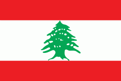
Country - Lebanon
 |
 |
| Flag of Lebanon | |
The earliest evidence of civilization in Lebanon dates back to 5,000 BCE. From c. 3200–539 BC, it was home to the flourishing Phoenician civilization before being annexed by various Near Eastern empires. In 64 BC, the Roman Empire conquered the region, and the region became a major center for Christianity under the Byzantine Empire. In the 7th century, the Muslim conquest of the Levant established caliphal rule. The 11th century saw the start of the Crusades and the establishment of Crusader States in the region only for it to be later reclaimed by the Ayyubids and Mamluks before being ceded to the Ottoman Empire in the 16th century. Under Sultan Abdulmejid I, the first Lebanese protostate took form in the 19th century as the Mount Lebanon Mutasarrifate, created as a home for the Maronite Christians under the Tanzimat reforms.
Currency / Language
| ISO | Currency | Symbol | Significant figures |
|---|---|---|---|
| LBP | Lebanese pound | لل | 2 |
| ISO | Language |
|---|---|
| AR | Arabic language |
| HY | Armenian language |
| EN | English language |
| FR | French language |